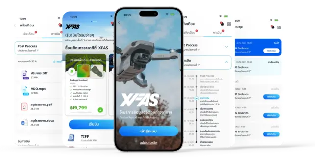
XFAS

Quick & Easy
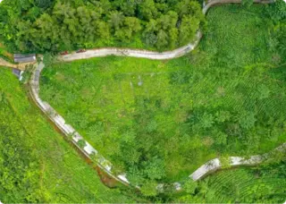
We are professional drone survey and mapping. We are young company driven to help achieving you business success.


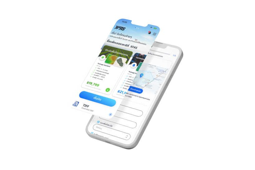
SELECT PACKAGE
Choose your plan
LET'S FLY
Launch the drone
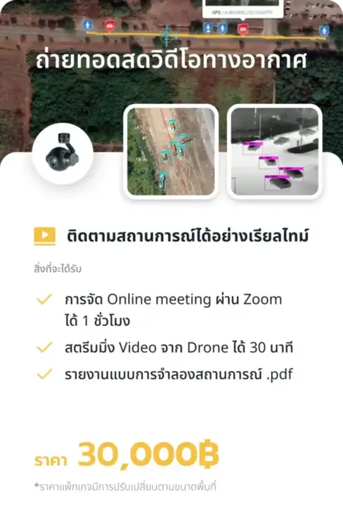
LIVE STREAM
Watch in real-time
GET FILES
Download your footage
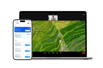
A complete aerial filming service using professional
grade drones and certified pilots.
Live streaming and high-quality footage delivery perfect for
documentaries, real estate, and corporate productions.
PLATFORM OVERVIEW
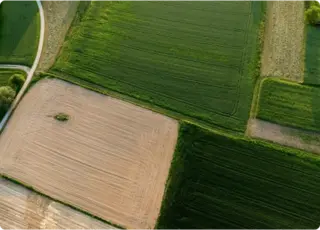
Let's get new experience with our service. You can get more photo views that you want.
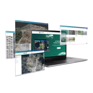
Drone box
Aerial photography map& 3D model model
ZOOM
Live drone real time
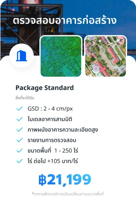
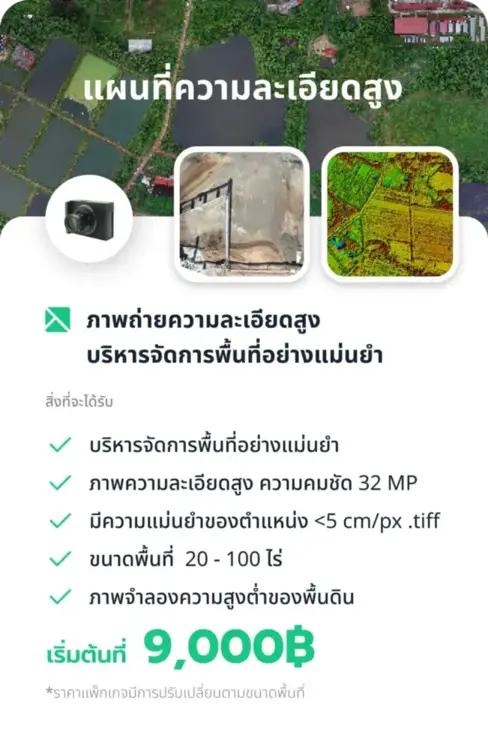
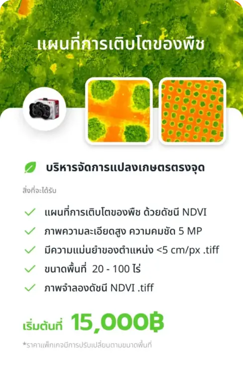
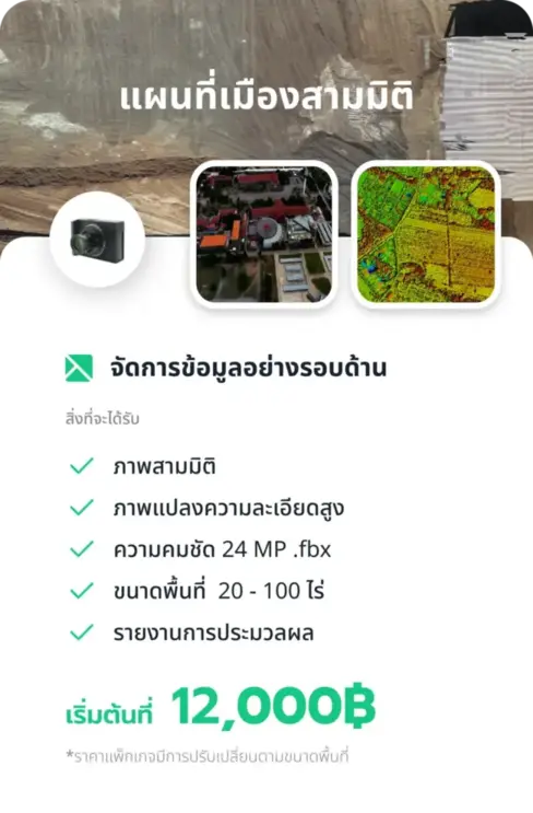
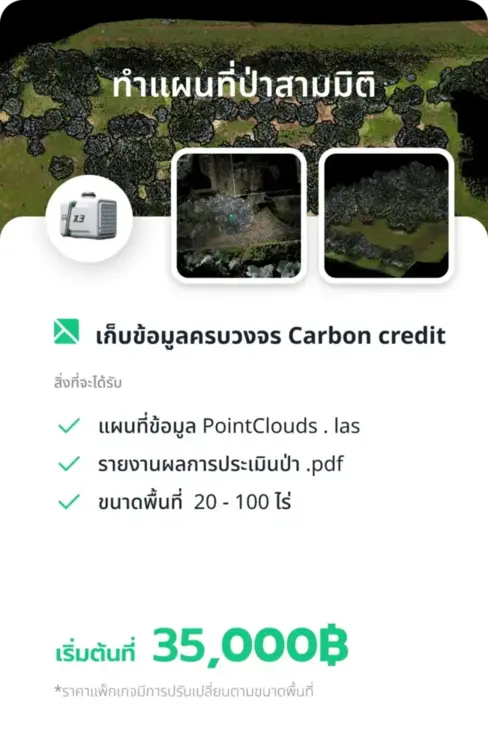
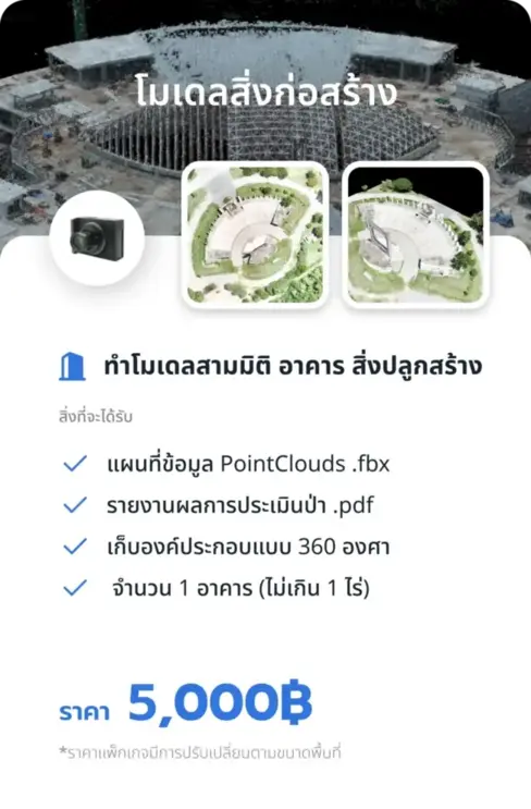
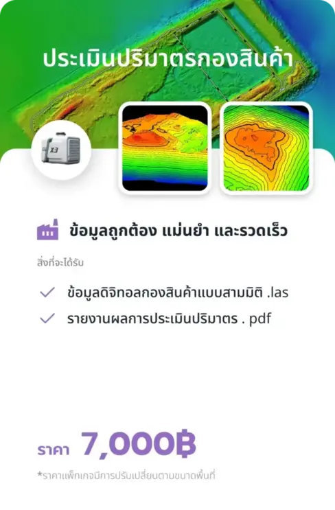
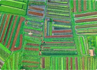
PACKAGE
Let's get new experience with our service. You can get more angle views
that you want. Let's see our packages.


OUR TEAM

Chainuwat Manotam
UNMANNED PILOT (UP)

Takurn Palawong
UNMANNED PILOT (UP)

Sornrob Headkhuntod
VISUAL OBSERVER (VO)

Thanaphat Khatawee
UNMANNED PILOT (UP)

Sornrob Headkhuntod
UNMANNED PILOT (UP)
COMMAND (UPIC) UU

Donyarit Sakerm
UNMANNED PILOT (UP)